National Taiwan Ocean University

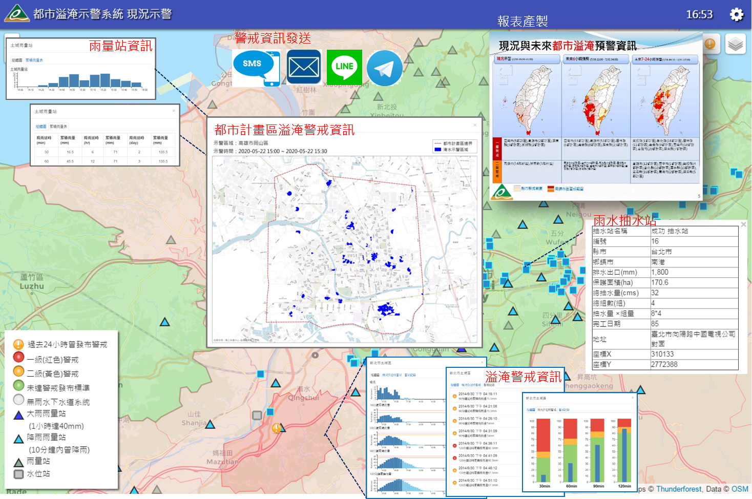
有鑑於近年來都市淹水災害日益嚴重,都市防災示警工作為營建署的重要任務之一。本中心協助建置「都市溢淹示警系統」,以各地區雨水下水道設計標準為基礎,設定下水道系統的雨量警戒值,提供全臺灣322個鄉(鎮、市、區)的都市淹水即時警戒資訊。


本系統主要功能包含現況示警、未來預警、報表、設定、參考資料、CEOC專區、進階管理等;以地圖應用服務為媒介展現空間查詢與展示資料,並直接於地圖上填入綠、黃、紅等警戒顏色呈現雨量警戒情況,同時可於線上產製即時報表,提供中央管理單位瞭解全臺警戒資訊。當超過雨量警戒值時,系統亦以手機簡訊或電子郵件方式直接通知權責人員,以達到即時示警的目的。


In view of the increasing severity of urban flooding disasters in recent years, urban disaster prevention and warning work is one of the important tasks of the Construction and Construction Department. GIS center assists in the establishment of the "urban flood warning system". Based on the design standards of stormwater sewers in various regions, the rainfall warning value of the sewer system is set, and the urban flood warning of 322 townships (towns, cities, districts) in Taiwan is provided. Information.


The main functions of this system include current status warning, future warning, report, setting, reference material, CEOC area, advanced management, etc.; use map application service as the medium to display space query and display data, and directly fill in green, yellow, and green on the map The warning colors such as red show the rainfall warning situation, and at the same time, real-time reports can be produced online to provide the central management unit with information about the warning of the whole Taiwan. When the rainfall warning value is exceeded, the system will also directly notify the responsible personnel by mobile phone text message or email, so as to achieve the purpose of instant warning.

聯絡資訊Contact information

基隆市中正區北寧路2號
No.2, Beining Rd., Jhongjheng District, Keelung, Tawan 20224 (R.O.C.)
+886-2-2462-2192 分機:6163

國立臺灣海洋大學地理資訊系統研究中心 版權所有 © 2022 ALL Rights Reserved